GeoSection Map 10.0

- Categoría: Graphic Editors
- Licencia: Shareware
- Tamaño: 10.13 KB
- Sistema: w2000 wXP
- Idiomas:

Graphic editor for topographic purposes for Map users.
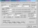
As there's an AutoDesk program to be applied to AutoCad and Land Desktop, you can now have it also for Map. This is an excellent graphical tool for editing terrain and road alignments, that comes equipped with plenty of maps and topographical utilities to apply to that application.
The main features of GeoSection Map: it allows you to perform field topographical readings, make adjustments, draw contour lines on the ground, generate tables of polygonal construction, insert vertices, longitudinal profiles, cross sections, and so on.
With GeoSection Map the user can also perform the calculation of volumes, perform treatments for coordinate systems, document in detail each of the specifications, add comments, run tools, coordinate conversions, create hierarchical modules of all processes underway, anticipate potential earthworks, and so on.
DownloadGeoSection Map 10.0 related downloads
ACDSee Photo Manager 18
 Download
International versions of this excellent image administrator and viewer, with many supplementary functions.


